Why DroneDeploy Roof Inspections Are Changing How Homeowners Protect Their Homes
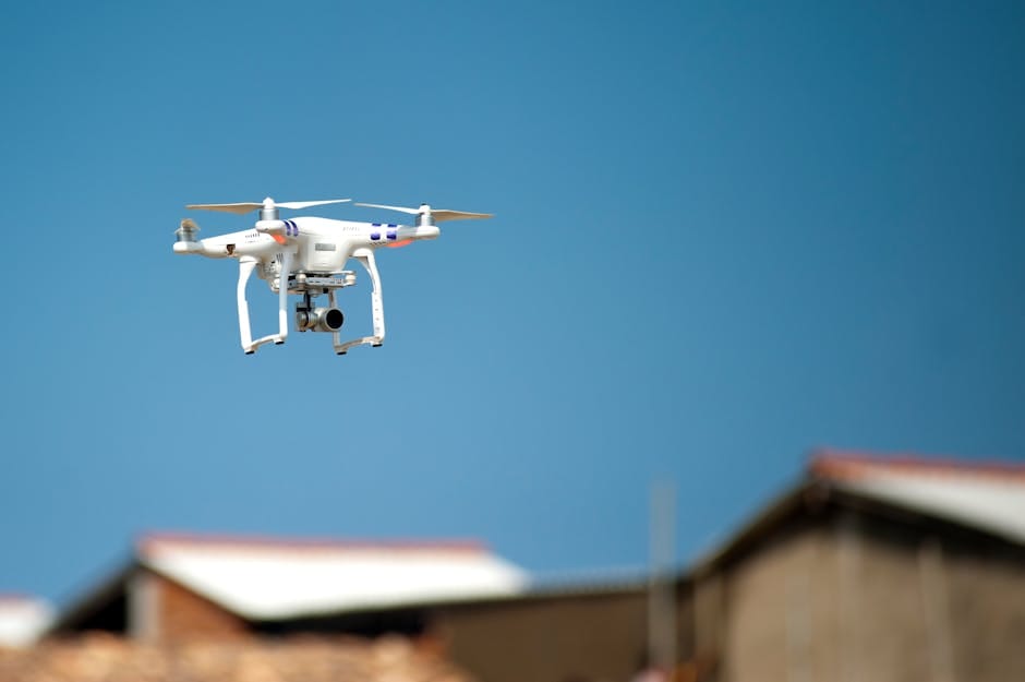
A DroneDeploy roof inspection is the most efficient and accurate method for identifying structural defects, moisture intrusion, and storm damage without the risks associated with manual ladder climbs. By utilizing high-resolution aerial data, homeowners can secure expert roofing services that provide a comprehensive digital record of their property’s condition. If you’ve recently dealt with storm damage in Texas or Oklahoma, here’s what you need to know fast:
How a DroneDeploy roof inspection works, in plain terms:
- A drone flies an automated path over your roof, capturing hundreds of overlapping images
- DroneDeploy processes those images into a detailed 3D model and thermal map
- The software automatically flags defects — leaks, moisture, insulation failures — ranked by severity
- A complete PDF report with accurate measurements is ready the same day
- Your roofing contractor reviews the findings and recommends repairs — no guesswork
This matters a lot if you’re a homeowner in Texas or Oklahoma. A professional roof inspection powered by drone technology finds the problems that a quick visual check misses every time. Hail, wind, and hurricane damage often hides where you can’t see it.
Traditional inspections mean a worker climbs onto your roof — which is, statistically, one of the most dangerous tasks in residential construction. Falling from roofs and ladders is the single most common injury on residential job sites. On top of that, 90% of roofing contractors are currently facing skilled labor shortages, making fast, accurate inspections harder to schedule and complete.
Drone-based inspections solve both problems at once. They’re faster, safer, and produce data that’s far more detailed than anything a person with a notepad can capture on foot.
I’m Cash Walker, a leadership team member at The Roof Guys with 30+ years of combined industry experience behind our team — and we’ve seen how DroneDeploy roof inspection tools are transforming the way we assess storm damage and protect homeowners across Houston and beyond. In this guide, I’ll walk you through everything you need to know to understand, use, and benefit from this technology.

The Evolution of Aerial Data: What is a DroneDeploy Roof Inspection?
Reality capture is the process of taking the physical world and turning it into a hyper-accurate digital twin. When we talk about a DroneDeploy roof inspection, we aren’t just talking about a drone taking a few pictures; we are talking about a sophisticated AI-driven platform that understands the “built world.” In the old days—about five years ago—an “aerial inspection” meant looking at grainy satellite photos that were three years out of date.
DroneDeploy is the industry leader in this space because it combines flight automation with powerful cloud processing. It uses photogrammetry—the science of making measurements from photographs—to stitch together hundreds of high-resolution images into a single, georeferenced map.
For our customers in places like Tulsa or Pasadena, TX, this means we can provide a digital record of your roof’s condition that is accurate down to the centimeter. Whether we are looking for hail bruises on shingles or checking the integrity of a commercial TPO membrane, the software provides a level of transparency that traditional methods simply can’t match.
High-Accuracy Measurements and 3D Modeling
One of the coolest parts of the process is the generation of 3D models. DroneDeploy doesn’t just show us a flat picture; it creates a volumetric model of your home. From this, we can extract:
- Orthomosaics: A high-resolution, top-down map of the entire property.
- DXF Files: Digital drawings that can be imported directly into CAD software for precise repair planning.
- Slope and Pitch: The software calculates the exact angle of every roof facet, which is vital for accurate material ordering.
- Point Clouds: A set of data points in space that represent the external surface of the building.
Automated Anomaly Detection
We don’t just rely on our eyes. DroneDeploy uses AI agents to scan the data for defects. It can identify cracks in tiles, ponding water on flat roofs, and even debris in gutters. By ranking these issues by severity, we can help property managers prioritize which buildings in a large portfolio—like an apartment complex in The Woodlands—need immediate attention and which can wait. For more technical details, you can always check the DroneDeploy Support Documentation.

Key Benefits: Why Drones are Replacing the Ladder
If you’ve ever seen a roofer balance on a steep pitch during a Houston summer, you know it’s a tough job. But beyond the “sweat factor,” there are hard numbers that prove drones are the superior choice for both the contractor and the homeowner.
According to the Bureau of Labor Statistics on roofing injuries, falling from roofs and ladders is the leading cause of injury in residential construction. By keeping our boots on the ground, we eliminate that risk entirely. But the benefits don’t stop at safety.
- 3x Faster Reporting: We can generate a comprehensive roof report three times faster than traditional manual methods.
- 20% Bottom Line Increase: Efficiency gains from 3D aerial mapping allow us to pass savings on to our customers and complete more projects with higher accuracy.
- Addressing Labor Shortages: With 90% of contractors dealing with skilled labor shortages, drones allow a single technician to do the work of a three-person crew in a fraction of the time.
Safety and Risk Mitigation
Safety isn’t just about avoiding falls; it’s about better documentation. If a storm hits Katy, TX, and you need to file an insurance claim, having a pre-loss drone map is gold. It provides indisputable evidence of the roof’s condition. Furthermore, some companies can even see lower insurance premiums by using drone data to identify and mitigate risks—like overhanging tree limbs or blocked drainage systems—before they cause a disaster.
Efficiency in the Face of Labor Shortages
In the roofing industry, time is everything, especially after a major storm in Oklahoma City. DroneDeploy’s RoofReport app can generate a complete and accurate roof plan within 48 hours. This rapid turnaround means we can get your roof replacement started while other companies are still struggling to get a surveyor out to the site.
Hardware and Flight Planning for Thermal Success
To get the best results, you need the right gear. Not every drone is up to the task of a professional dronedeploy roof inspection. For high-end thermal work, we typically look at the DJI Mavic 3 Thermal (M3T) or the enterprise-grade FLIR XT2.
| Feature | DJI Mavic 3 Thermal | FLIR XT2 (on M210/M300) |
|---|---|---|
| Thermal Resolution | 640 x 512 | 640 x 512 |
| Visual Camera | 20MP / 48MP | 12MP |
| Portability | Ultra-portable (folding) | Heavy-duty |
| Lens Options | Fixed | 9mm, 13mm, 19mm |
| Best Use Case | Residential & Light Commercial | Industrial & Large Scale |
For thermal inspections, the 13mm lens is often the “sweet spot” because it provides a wide enough field of view to be efficient while maintaining the detail needed to see temperature variations.
Step-by-Step Guide to a DroneDeploy Roof Inspection with Mavic 3 Thermal
Conducting a thermal flight requires more than just pushing a button. Here is our internal protocol:
- Pre-Flight Calibration: Ensure the thermal sensor is calibrated to the current ambient temperature.
- Set Emissivity: For most asphalt or concrete roofs, we set the emissivity to 0.95. This ensures the camera accurately reads the heat being emitted by the roofing material.
- Flight Overlap: We set the flight path for 70-80% front and side overlap. This is crucial for stitching the thermal images into a “Thermal Live Map.”
- Altitude: We fly between 50 and 120 meters. Flying lower (50-80m) provides better resolution for detecting small leaks.
- Speed: Keep the drone slow, typically 3-5 m/s, to avoid motion blur in the thermal sensor.
- Color Palette: We use the Ironbow palette, which makes hot and cold spots pop with high contrast.
Optimal Flight Parameters for Roof Coverage
Timing is everything for thermal. If you fly at high noon, the sun’s glare (solar loading) will wash out the thermal signatures. We prefer flying in the early morning or late afternoon when the “thermal crossover” occurs. This is when the roof materials have cooled down, but trapped moisture under the membrane remains warm, making leaks glow on our screens.
Analyzing Data: Detecting Leaks and Generating Reports
The real magic happens after the drone lands. Once the images are uploaded to DroneDeploy, the software generates a Sample DroneDeploy Roof Report. This isn’t just a collection of photos; it’s an actionable document.
Thermal imaging is the “X-ray vision” of the roofing world. It helps us detect:
- Moisture Intrusion: Water has a higher thermal mass than dry insulation. At night, wet spots stay warm longer, showing up as “hot spots.”
- Insulation Failure: Areas where heat is escaping the building indicate missing or degraded insulation.
- Thermal Bridging: Identifying where the building’s structure is conducting heat away from the interior.
Maximizing ROI with the DroneDeploy Roof Inspection App Ecosystem
The DroneDeploy App Market is full of specialized tools. The RoofReport app is a favorite because it automates the creation of roof plans, including facets, hips, ridges, and valleys. There is also a dedicated Thermal Roof Inspection app that automates camera geometry specifically for the 13mm lens, ensuring that every pixel of your roof is covered.
Integrating with Enterprise Workflows
For our commercial clients in Houston or Tulsa, we don’t work in a vacuum. DroneDeploy integrates seamlessly with tools like Procore, Autodesk, and BIM 360. This allows us to connect properties virtually, syncing roof issues directly into the project management software your team uses every day. This level of integration reduces administrative overhead and ensures that nothing falls through the cracks.
Safety, Compliance, and Portfolio Management
Managing one roof is easy. Managing a portfolio of 50 shopping centers across Texas and Oklahoma is a nightmare—unless you have the right data. DroneDeploy allows property managers to oversee their entire portfolio from a single dashboard.
By digitizing every property, you can:
- Prioritize Repairs: Use AI-ranked defect reports to decide which roof needs a $10,000 repair today and which can wait until next year.
- Capital Planning: Create a baseline of your roof’s condition to track degradation over time.
- Remote Oversight: A property manager in Oklahoma City can virtually “walk” a roof in Conroe, TX, without leaving their office.
Managing Large-Scale Property Portfolios
The platform acts as a “Digital Dig Board.” It stores year-over-year comparisons, so you can see exactly how a hailstorm in Spring, TX, affected your assets compared to the previous year. This historical data is invaluable for long-term maintenance and proving the necessity of a full replacement to stakeholders.
Compliance and Insurance Documentation
In the roofing world, if it isn’t documented, it didn’t happen. DroneDeploy provides enterprise-grade security (ISO 27001, SOC 2 Type 2, and GDPR compliance) for all your data. After a disaster, we can provide post-disaster mapping that matches your pre-loss records, making the insurance claim process for storm damage significantly smoother. We also ensure all our pilots fly under FAA Part 107 standards, keeping your project compliant with federal law.
Frequently Asked Questions about Drone Roof Inspections
What is the best drone for DroneDeploy roof inspections?
For most residential and commercial applications, the DJI Mavic 3 Thermal is the gold standard. It offers the perfect balance of high-resolution visual imaging (for seeing shingle damage) and high-resolution thermal imaging (for seeing leaks), all in a portable package that is easy to deploy quickly.
How does thermal imaging detect roof leaks?
Thermal imaging doesn’t “see” water; it sees the temperature difference caused by water. Because water holds onto heat longer than dry roofing materials, a wet patch of insulation will appear warmer than the surrounding dry roof after the sun goes down. This allows us to pinpoint the exact location of a leak that might be invisible to the naked eye.
How accurate are DroneDeploy roof measurements?
Very. When flown correctly with high overlap and a good GPS lock, DroneDeploy’s measurements are typically within 1-2% of manual hand-measurements. For even higher precision, we can use Ground Control Points (GCPs) or RTK-enabled drones to achieve sub-centimeter accuracy.
Conclusion
The Roof Guys provides cutting-edge technology to homeowners and property managers across Texas and Oklahoma. A dronedeploy roof inspection offers superior safety, speed, and accuracy compared to traditional manual methods. This technology is essential for homeowners in Houston recovering from storm damage and property managers in Tulsa seeking to optimize maintenance schedules.
All projects include a 10-year warranty and rapid turnaround times to address active leaks immediately. Data-driven inspections eliminate the guesswork associated with manual assessments, ensuring your property is protected by precise measurements and AI-driven defect detection.
Ready to see your roof in a whole new light? Call us at 888-555-0199 or Schedule your professional drone roof inspection today. We’ll bring the site to you.